France firestorm phenomenon: monster clouds that spawn lightning and new blazes
A wildfire in southwest France grew so powerful that its smoke column became a thunderstorm, generating lightning that struck the ground and ignited new fires beyond the original blaze.
Intelligence analysis by Llama
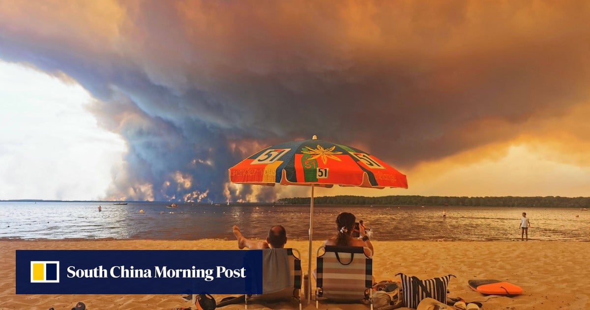
A rare fire cloud, known as a pyrocumulonimbus, has been recorded in France for the first time, generating lightning and new fires in the southwest region.
Imagine a huge cloud of smoke and heat from a wildfire that gets so big it starts to make its own thunderstorm, complete with lightning and strong winds. This is called a pyrocumulonimbus, and it's a rare and powerful phenomenon that can make it even harder to contain the fire.
Analysis
A Rare Fire Cloud Forms Over France
A wildfire in southwest France has grown so powerful that its smoke column has become a thunderstorm, generating lightning that struck the ground and ignited new fires beyond the original blaze. This phenomenon, known as a pyrocumulonimbus, or pyroCb, is rare in Europe and more commonly documented in North America and Australia, where it occurs only over some of the most extreme fires.
The blaze erupted near Saumos on July 22 and has since burned more than 420 sq km (162 square miles) of forests and scrubland, damaged or destroyed more than 240 homes, and forced 220,000 people to evacuate in Gironde. At about 6.20pm on Friday, two days after the fire began, the departmental fire and rescue service said it had generated a pyrocumulonimbus. The cloud weakened overnight as humidity rose, then formed again several times.
Repeatedly, heat and smoke have surged upwards into a vast black thundercloud, electrified and lit from within. This is a sign of the extreme heat and energy released by the fire, which is capable of generating its own weather system. The pyrocumulonimbus is a rare and powerful phenomenon that highlights the intensity of the wildfire and the need for continued efforts to contain it.
The Implications of a Pyrocumulonimbus
The formation of a pyrocumulonimbus has significant implications for the fire and the surrounding area. The cloud can produce violent, erratic winds capable of driving the flames in new directions, making it even more challenging to contain the fire. Additionally, the lightning generated by the cloud can ignite new fires, further exacerbating the situation.
The Road Ahead
As the fire continues to burn, it is essential to monitor the situation closely and take necessary precautions to ensure public safety. The formation of a pyrocumulonimbus is a reminder of the extreme nature of the wildfire and the need for continued efforts to contain it. The situation will be closely watched in the coming days as the fire continues to burn and the weather conditions evolve.
Key points
- A wildfire in southwest France has grown so powerful that its smoke column has become a thunderstorm, generating lightning and new fires beyond the original blaze.
- The phenomenon, known as a pyrocumulonimbus, is rare in Europe and more commonly documented in North America and Australia.
- The fire has burned over 420 sq km of forests and scrubland, damaged or destroyed over 240 homes, and forced 220,000 people to evacuate.
If the fire can be contained and the weather conditions improve, there is a possibility that the situation can be brought under control, and the affected areas can be restored to their original state.
However, the formation of a pyrocumulonimbus indicates the extreme intensity of the wildfire, and the situation may continue to deteriorate, leading to further damage and displacement.
