Google darkens satellite imagery of sites hit in Kuwait
Google has heavily blurred and downgraded the quality of satellite imagery covering several sensitive installations in Kuwait that were recently targeted during Iran’s retaliatory strikes against U.S. operations.
Intelligence analysis by Llama
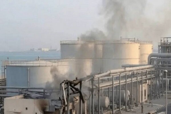
Google has intentionally obscured high-resolution views of multiple critical infrastructure sites in Kuwait’s Al-Shuaiba region, including a major power plant, a water desalination facility, several oil refineries, and a petrochemical complex.
Google has made the pictures of some important buildings in Kuwait blurry so that people can't see how damaged they are. This is happening because of a big fight between Iran and the US, and Google doesn't want to show the damage to these buildings.
Analysis
A Coordinated Effort to Control the Flow of Visual Data
Google's decision to heavily blur and downgrade the quality of satellite imagery covering several sensitive installations in Kuwait is a stark reminder of the ongoing efforts to control the flow of visual data in the region. This development follows earlier reports by an American media analyst who noted that major satellite imagery providers, including Google and Apple, have heavily censored or downgraded the resolution of key Kuwaiti military installations.
The Policy of Both War and Negotiations 'Over'
In a recent statement, a former IRGC commander stated that the policy of both war and negotiations is 'over'. This statement comes as Iran continues to retaliate against US operations in the region, with the IRGC Navy pounding US support sites in Kuwait and Bahrain.
The Information Battlefield
Experts suggest that these combined efforts by commercial satellite companies are aimed at preventing real-time damage assessment and mitigating the information battlefield following the high-stakes military escalations in the region. This is not an isolated incident, as satellite imaging firm Planet Labs previously announced that it would enforce a mandatory 96-hour delay on the release of new imagery covering the Middle East—specifically targeting the Persian Gulf countries, Iraq, and Kuwait.
The Implications
The implications of this development are far-reaching, as it suggests that commercial satellite companies are actively working to prevent real-time damage assessment and mitigate the information battlefield. This has significant implications for the ongoing conflict in the region, as it limits the ability of observers to assess the exact extent of the damage or identify specific structural impacts within these vital facilities.
Key points
- Google has heavily blurred and downgraded the quality of satellite imagery covering several sensitive installations in Kuwait.
- The affected areas include a major power plant, a water desalination facility, several oil refineries, and a petrochemical complex.
- This development follows earlier reports by an American media analyst who noted that major satellite imagery providers, including Google and Apple, have heavily censored or downgraded the resolution of key Kuwaiti military installations.
- Experts suggest that these combined efforts by commercial satellite companies are aimed at preventing real-time damage assessment and mitigating the information battlefield following the high-stakes military escalations in the region.
If this development plays out positively, it could lead to a decrease in the escalation of the conflict in the region, as commercial satellite companies may be less likely to censor or downgrade the resolution of key military installations.
However, if this development is not addressed, it could lead to a further escalation of the conflict, as the lack of transparency and real-time damage assessment could lead to miscalculations and further violence.