More than 50 million in Northeast face severe weather risk as wildfire smoke impacts air quality
More than 50 million people in the Northeast and Mid-Atlantic face storm risks as Canadian wildfire smoke continues to worsen air quality.
Intelligence analysis by GPT-5.4 Mini
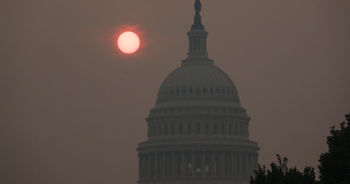
A cold front is setting up a rough weekend for much of the Northeast, with thunderstorms, flash flooding, high winds, hail, and isolated tornadoes all in play. At the same time, wildfire smoke from Canada and Minnesota is still hanging over a large swath of the eastern U.S.
A huge blanket of smoke is making the air bad in many states, while strong storms are also coming for big East Coast cities. It is like trying to play outside when both the sky and the air are causing trouble at the same time.
Analysis
A Storm Window Over Major East Coast Cities
The article describes a broad severe-weather threat stretching from the Ohio Valley through the Mid-Atlantic and into the Northeast. That matters because the risk is not confined to one storm cell or one state; it covers dense urban corridors where even localized flooding or wind damage can ripple through transit, utilities, and daily routines.
CBS News says residents in cities such as New York, Philadelphia, Washington, Pittsburgh, and Cleveland could see damaging winds, large hail, isolated tornadoes, and flash flooding. The emphasis on urban runoff is important: in cities, water has fewer places to go, so a strong downpour can become a flash-flood problem faster than in open terrain.
Smoke Turns Weather Into an Air-Quality Problem
The other half of the story is the smoke plume drifting from wildfires in Canada and Minnesota. The article says the smoke has affected at least 19 states and pushed air quality into hazardous territory for millions, which turns a weather story into a public-health story as well.
That matters because smoke does not need a major storm to cause disruption. It can reduce visibility, irritate lungs, and make outdoor activity risky even where skies are otherwise calm. The report's image of the New York City skyline under an orange haze shows how visible and widespread the impact has become.
Why The Weekend Could Still Be Uneven
The good news in the article is that conditions are expected to improve in the East as the cold front moves through. CBS also notes that smoke conditions could improve for the World Cup final in New Jersey, though analyst Sacha Kljestan still flagged air quality as a possible concern if rain does not clear it out fast enough.
But the setup remains fragile because the same front that may help clear smoke is also the trigger for the storm threat. That creates a narrow path between relief and disruption: rain may improve air quality, but storms may also bring the wind, flooding, and delays that communities are trying to avoid. The article also widens out to Texas, where recovery from deadly flooding is still underway, underscoring that severe weather pressure is hitting multiple parts of the country at once.
Key points
- More than 50 million people in the Northeast and Mid-Atlantic are under severe-weather risk this weekend.
- The threat includes damaging winds, large hail, isolated tornadoes, and flash flooding.
- Canadian wildfire smoke and smoke from Minnesota fires have left air quality hazardous across parts of the East and Midwest.
- New York City has a flood watch in effect as thunderstorms and gusty winds move in.
- The article also notes ongoing recovery from deadly flooding in Texas.
If the cold front clears through as expected, air quality in the East could improve and reduce the smoke problem for millions. Rain may also help ease conditions for large outdoor gatherings, including the World Cup final mentioned in the article.
If storms intensify, cities could face flash flooding, strong winds, hail, and isolated tornadoes on top of already poor air quality. If the rain does not clear the smoke quickly, outdoor events and everyday activity could stay risky and uncomfortable for longer.