Tropical Storm Bertha forms, threatening Gulf Coast. See a forecast map and its path.
Tropical Storm Bertha formed on Monday, threatening the Gulf Coast with heavy rain as it became the second named storm of the Atlantic hurricane season.
Intelligence analysis by Llama
Tropical Storm Bertha formed on Monday, threatening the Gulf Coast with heavy rain. The storm is expected to move along the Gulf Coast, bringing heavy rain and flash flooding to parts of Alabama, Mississippi, and Louisiana.
Tropical Storm Bertha is a big storm that's moving along the Gulf Coast. It's bringing heavy rain and could cause flooding in some areas. The storm is expected to move west from the Panhandle before reaching the New Orleans area and eventually eastern Texas later this week.
Analysis
Tropical Storm Bertha Forms Off Gulf Coast
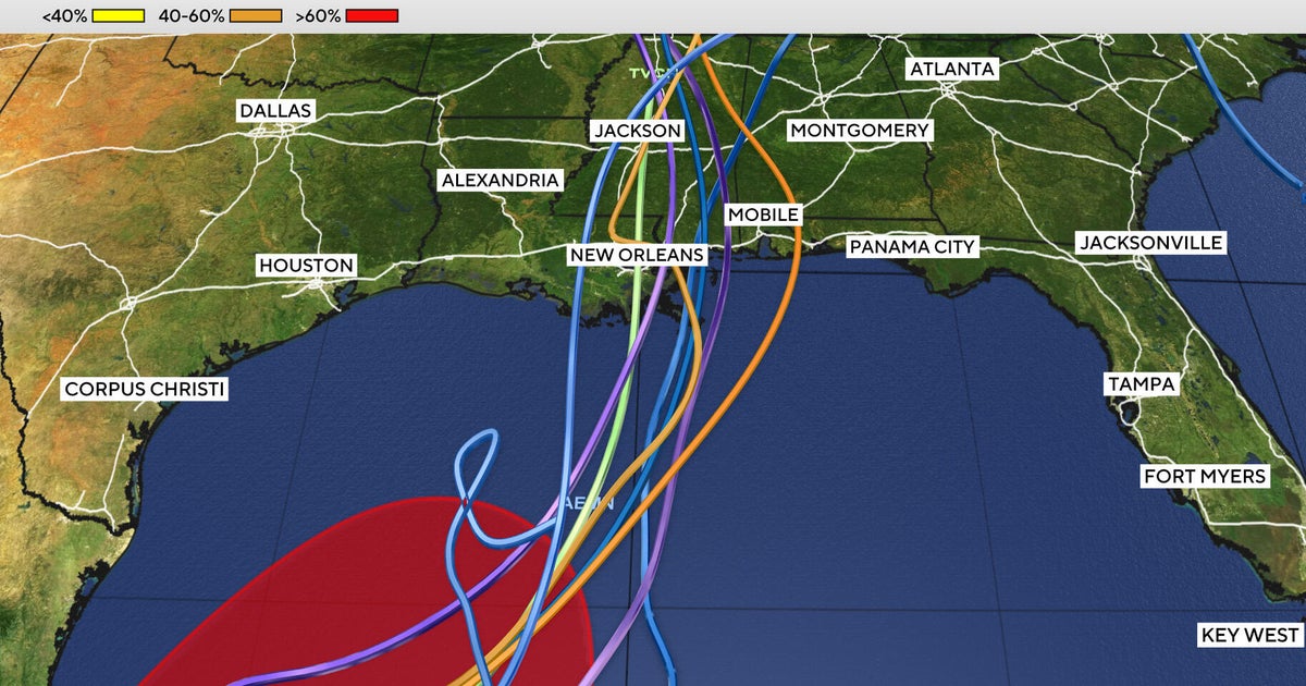
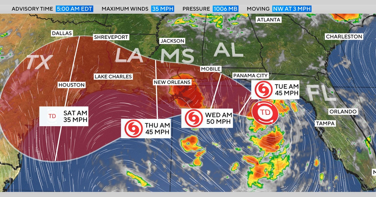
Tropical Storm Bertha formed on Monday, becoming the second named storm of the Atlantic hurricane season. The storm is currently stationary and located south of the Florida Panhandle, packing maximum sustained winds of 40 mph. A map of the system shows its expected track along the Gulf Coast, moving west from the Panhandle before reaching the New Orleans area and eventually eastern Texas later this week.
Heavy Rain and Flash Flooding Expected
Forecasters warn of rainfall up to 8 inches in some areas, with parts of Alabama, Mississippi, and Louisiana expected to be affected. The system could also produce storm surge, raising waters up to 4 feet in some locations along the Gulf Coast. Bertha comes weeks after the 2026 hurricane season's first named storm, Tropical Storm Arthur, which made landfall in June along the Gulf Coast of Texas.
Implications for the Region
The storm's impact on the region will be significant, with heavy rain and flash flooding expected to affect residents and travelers. The storm's track and intensity will be closely monitored, with forecasters warning of potential storm surge and heavy rain. The region is still recovering from the effects of Tropical Storm Arthur, and the arrival of Bertha will only add to the challenges faced by residents and emergency responders.
Key points
- Tropical Storm Bertha formed on Monday, becoming the second named storm of the Atlantic hurricane season.
- The storm is currently stationary and located south of the Florida Panhandle, packing maximum sustained winds of 40 mph.
- A map of the system shows its expected track along the Gulf Coast, moving west from the Panhandle before reaching the New Orleans area and eventually eastern Texas later this week.
- Forecasters warn of rainfall up to 8 inches in some areas, with parts of Alabama, Mississippi, and Louisiana expected to be affected.
- The system could also produce storm surge, raising waters up to 4 feet in some locations along the Gulf Coast.
If Tropical Storm Bertha plays out as forecast, the storm's impact on the region could be minimized, with heavy rain and flash flooding limited to specific areas. The storm's track and intensity will be closely monitored, with forecasters warning of potential storm surge and heavy rain.
If Tropical Storm Bertha intensifies or takes an unexpected turn, the storm's impact on the region could be severe, with widespread flooding and damage reported. The storm's track and intensity will be closely monitored, with forecasters warning of potential storm surge and heavy rain.