'We are waiting with bated breath': gathering El Niño could be the strongest on record, BoM says
Australia's Bureau of Meteorology warns the developing El Niño could be the strongest on record, with sea surface temperatures potentially peaking above +3C in the key Pacific monitoring region.
Intelligence analysis by Llama
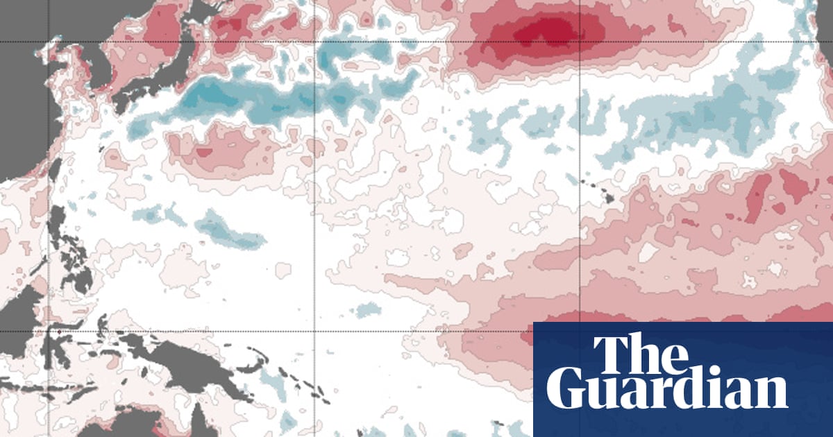
Australia's Bureau of Meteorology says the developing El Niño could be the strongest on record, potentially topping the +2.6C peak seen in 1983. Climate models suggest the system could peak between +2.2C and above +3C, raising fears it could combine with global heating to deliver the hottest year ever recorded.
Imagine the Pacific Ocean is a giant bathtub that's been collecting extra heat for years. Now it's pouring that heat into the air. Scientists call this El Niño, and they think this one could be the biggest ever — making many parts of the world much hotter and drier than usual.
Analysis
A Heat Pulse Without Historical Precedent
The El Niño event now locked in across the equatorial Pacific is being tracked by climatologists with what one expert called "deep concern" and another described as "mind-blowing." Sea surface temperatures in the Niño 3.4 region — the benchmark zone for measuring El Niño strength — are projected to peak somewhere between +2.2C and above +3C, according to Dr Zhi-Weng Chua of the Bureau of Meteorology. The previous high-water mark for that measurement was a monthly average of +2.6C in January 1983. The bureau's own model goes further, suggesting a peak near +3.3C.
Dr Zeke Hausfather of Berkeley Earth, after reviewing 14 different seasonal model forecasts from around the world, wrote in The Climate Brink newsletter that the event "may end up the strongest by a truly mind-blowing margin" and that "the models are forecasting something outside the envelope of anything we have ever observed." That framing — outside observed history — captures the scale of the stakes. Decades of accumulated ocean heat, absorbed by the Pacific, are now being released into the atmosphere in a single pulse. Globally, scientists warn this could combine with the underlying warming trend to deliver either this year or, more likely, 2027 as the hottest year on record.
Australia on the Front Line
For Australia, the bureau has stressed that the strength of an El Niño does not always translate into the severity of local impacts. But the long-range forecast for August to October paints a stark picture. Brisbane, Sydney, Melbourne, Hobart, Adelaide and Perth all face at least an 80% chance of maximum temperatures landing in the top 20% on record for that period, along with an increased probability of unusually low rainfall. The bureau's maps show deep red blanketing the continent's south and east, signalling a high probability of record-warm spring conditions.
Prof Sarah Perkins-Kirkpatrick of the Australian National University captured the prevailing mood among researchers: "Every time I look at it, I have this sense of awe but deep concern. I think it will be one for the record books." That mix of wonder and alarm is now rippling through meteorological agencies worldwide, as fire authorities, water managers, and public health agencies prepare for a punishing southern hemisphere spring and summer.
The Indian Ocean Wild Card
Dr Kim Reid of the University of Melbourne is watching a second variable that could amplify the disaster: the Indian Ocean. Some models are predicting cooling in waters off Australia's north-west — a configuration known as a positive Indian Ocean Dipole. When that pattern has combined with El Niño in the past, the consequences have been severe, including the "tinderbox drought" that preceded Australia's black summer bushfires of 2019-2020. Should a strong positive Indian Ocean Dipole develop in lockstep with this record-leaning El Niño, the compound event would test emergency planning in ways not seen in living memory — and serve as a warning to other nations in the southern hemisphere already on edge from a rapidly warming planet.
Key points
- Australia's Bureau of Meteorology says the developing El Niño could be the strongest on record
- Models project peak sea surface temperatures of +2.2C to above +3C in the Niño 3.4 region, surpassing the +2.6C record from January 1983
- Brisbane, Sydney, Melbourne, Hobart, Adelaide and Perth all face at least an 80% chance of unusually warm and dry conditions from August to October
- A concurrent positive Indian Ocean Dipole could amplify impacts, echoing the conditions that preceded the 2019-2020 black summer bushfires
- Combined with global heating, a strong El Niño could deliver the hottest year on record, with 2027 the more likely candidate
The Bureau of Meteorology's early warning gives Australian authorities, farmers, and emergency services weeks to prepare — time to bolster fire defenses, pre-position water resources, and protect vulnerable communities before the worst impacts arrive. Long-range forecasts of this accuracy are themselves a product of decades of climate science investment.
If El Niño peaks above +3C as the bureau's own model suggests, and a positive Indian Ocean Dipole develops in parallel, Australia could face fire and drought conditions rivaling or exceeding the 2019-2020 black summer. Globally, the combined effect on top of human-caused warming could shatter temperature records, strain food systems, and trigger simultaneous humanitarian stress across multiple continents.