Storm Austen forecast to hit southern UK
Storm Austen, the first named storm of the season, is set to bring strong winds of up to 60mph to southern UK regions by Friday. A yellow severe weather warning is in effect for parts of south-west England and southern Wales.
Intelligence analysis by Gemini 2.5 Flash Lite
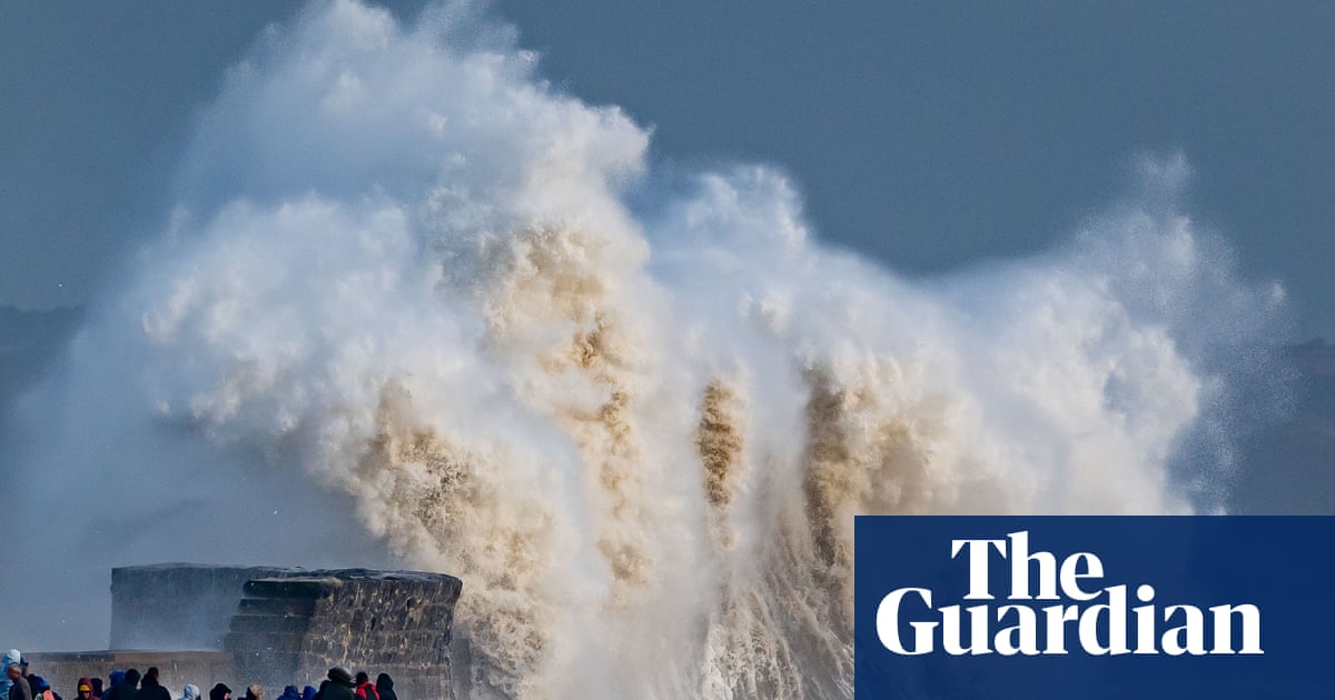
The Met Office has named Storm Austen, signaling its potential to cause disruption with gusts up to 60mph expected in southern UK areas by Friday. A yellow severe weather warning covers much of south-west England and southern Wales, with coastal areas potentially seeing gusts over 70mph. The storm's naming highlights the importance of public awareness and preparedness for severe weath…
Imagine the sky is like a big playground, and sometimes the wind gets really strong and blows things around. When the wind gets strong enough to be a bit of a bother, like knocking over toys, grown-ups give it a name, like 'Austen'. This helps everyone know to be extra careful and stay inside or hold on tight, just like when you know a big wave is coming at the beach.
Analysis
Storm Naming Convention
The Met Office's storm naming system, initiated in 2015, operates on an alphabetical list from September to August each year. This year's list begins with Austen and progresses through the alphabet, excluding Q, U, X, Y, and Z, in line with international meteorological practices. The names are collaboratively chosen by the Met Office, Met Éireann (Ireland), and KNMI (Netherlands). Austen was specifically selected by Met Éireann to honor Austen Nagle, the service's first director, while other names, like Chloe, are derived from public suggestions. This structured approach aims to provide a clear, memorable identifier for significant weather events, enhancing public understanding and response.
Potential for Disruption
Storm Austen is forecast to approach the UK's south-west by Thursday, driven by a rapidly deepening area of low pressure in the Atlantic, invigorated by the jet stream. The Met Office has issued a yellow severe weather warning for strong winds from midnight to midday on Friday, encompassing most of south-west England and southern Wales, with parts of the south coast as far east as Brighton also expected to be affected. Peak gusts could exceed 70mph in the most exposed coastal areas, with 50-60mph likely more widely within the warning zone. The storm is expected to move eastwards through Friday, with winds diminishing later in the day, though further wind and rain are probable throughout the weekend and into the following week, particularly in western areas.
Communicating Weather Risks
According to Holly Clements, the Met Office head of warnings and guidance, storm naming has been instrumental in communicating the risks associated with severe weather for over a decade. A named storm serves as a clear focal point for forecasts and warnings, enabling the public to better grasp potential impacts and take necessary actions to safeguard themselves, their families, and their property. This system moves beyond generic weather alerts, providing a distinct identity to significant weather systems that have the potential to cause disruption or damage, thereby fostering a more proactive and informed public response to impending meteorological threats.
Key points
- Storm Austen is the first named storm of the season, bringing strong winds to southern UK.
- A yellow severe weather warning is in effect for Friday, covering south-west England and southern Wales.
- Gusts of up to 60mph are expected, with coastal areas potentially seeing over 70mph.
- The Met Office uses storm names to improve communication of severe weather risks and encourage public preparedness.
- The storm naming convention involves collaboration with Irish and Dutch meteorological services.
The effective communication of Storm Austen's potential impacts through its naming could lead to increased public preparedness, minimizing damage to property and ensuring fewer injuries. Early warnings and clear guidance may allow communities to take proactive measures, mitigating the worst effects of the strong winds and heavy rain.
Despite the yellow warning, the storm's exact track and intensity remain uncertain, meaning there's a risk of more severe impacts than currently forecast, particularly in coastal or exposed areas. If preparedness measures are not widely adopted or if the storm intensifies unexpectedly, disruption to transport, power supplies, and daily life could be significant.